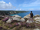
Walks in Cornwall with a good chance of seeing choughs
Enjoy the walks by being guided by the app
-
2.5 miles/4 km - Easy
Botallack Head
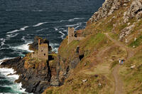
Botallack Head
2.5 miles/4 km - Easy
A circular walk around Cornwall's most iconic mining remains, used for the filming of the BBC's Poldark series
-
3.9 miles/6.3 km - Easy-moderate
Land's End
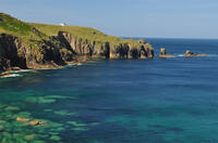
Land's End
3.9 miles/6.3 km - Easy-moderate
A circular walk on the rugged cliffs at the most westerly point of the British mainland with spectacular views and spectacular wildflowers.
-
3.1 miles/5 km - Moderate
Porthgwarra to Minack
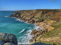
Porthgwarra to Minack
3.1 miles/5 km - Moderate
A circular walk to the Minack Theatre, via St Levan's church, St Leven's Holy Well and Porthchapel beach, from Porthgwarra where the beach is accessed via a rock tunnel created by local miners.
-
3.2 miles/5.1 km - Moderate
Lizard to Kynance Cove (shorter version)
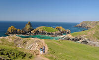
Lizard to Kynance Cove (shorter version)
3.2 miles/5.1 km - Moderate
A circular walk from Lizard village to Kynance Cove with spectacular views, wildflowers including Cornwall's county flower and wildlife including the Cornish Chough.
-
3.7 miles/6 km - Moderate
St Just to Cape Cornwall
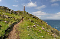
St Just to Cape Cornwall
3.7 miles/6 km - Moderate
A circular walk from St Just to the rugged coast of England's only Cape topped by a monument fashioned from a mine chimney, passing mediaeval and prehistoric remains.
-
3.8 miles/6.1 km - Moderate
Porth Nanven to Nanquidno
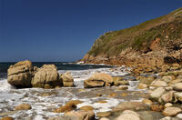
Porth Nanven to Nanquidno
3.8 miles/6.1 km - Moderate
A circular walk from the Cot Valley past the beaches of Nanquidno and Porth Nanven where granite boulders polished over millions of years by prehistoric oceans and then buried by the soil are being exposed once again by the sea.
-
4.4 miles/7.1 km - Moderate
The Lizard and Kynance Cove
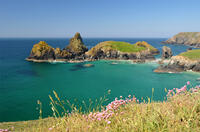
The Lizard and Kynance Cove
4.4 miles/7.1 km - Moderate
A circular walk along the Victorian Excursion route from Lizard village to the most southerly point and along the coast path to Kynance Cove with spectacular views, wildflowers, and wildlife including the Cornish Chough.
-
5.2 miles/8.3 km - Moderate
Sennen Cove to Nanquidno
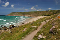
Sennen Cove to Nanquidno
5.2 miles/8.3 km - Moderate
A circular walk alongside the pristine beaches of Whitesand Bay, where shoals of mullet are still caught off the beach using the traditional seine nets in the way they have for hundreds of years.
-
5.4 miles/8.6 km - Moderate
Cape Cornwall to Levant
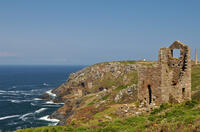
Cape Cornwall to Levant
5.4 miles/8.6 km - Moderate
A circular walk from England's only Cape, via the engine houses of Kenidjack Valley and perched on rock ledges at Botallack Head, to Levant Mine which had over 60 miles of tunnels beneath the Atlantic and now has a working restored beam engine.
-
6 miles/9.7 km - Moderate
Sennen Cove, Land's End and Nanjizal
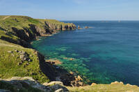
Sennen Cove, Land's End and Nanjizal
6 miles/9.7 km - Moderate
A circular walk from the white sandy beach at Sennen Cove along the towering granite cliffs via Land's End to the song of the sea cave at Nanjizal. The best way to see Land's End.
-
7.4 miles/11.8 km - Moderate
St Just to Nanquidno
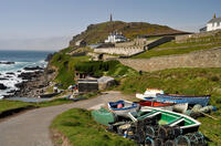
St Just to Nanquidno
7.4 miles/11.8 km - Moderate
A circular walk from St Just to Cape Cornwall and the Cot Valley, where an ancient beach has been eroded from the cliffs at Porth Nanven, releasing granite boulders resembling Dinosaur eggs.
-
5.4 miles/8.7 km - Moderate-strenuous
Porthcurno, Porthgwarra and Gwennap Head
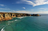
Porthcurno, Porthgwarra and Gwennap Head
5.4 miles/8.7 km - Moderate-strenuous
A circular walk from Porthcurno, passing the Minack Theatre, St Leven's Holy Well, Porthchapel and Porthgwarra beaches, to Gwennap Head where the English Channel meets the Atlantic and the Runnelstone Reef has claimed so many ships that divers are unsure where the wreckage is from.
-
5.4 miles/8.6 km - Moderate-strenuous
Zennor to The Carracks
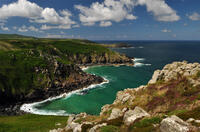
Zennor to The Carracks
5.4 miles/8.6 km - Moderate-strenuous
A circular walk towards St Ives from Zennor following the Coast Path past the haunts of the legendary mermaid of Zennor to the islets of The Carracks, frequented by seals, and returning on the Coffin Path, along which villagers made their final journey to Zennor church.
-
6.8 miles/10.9 km - Moderate-strenuous
Porthleven to Rinsey Head
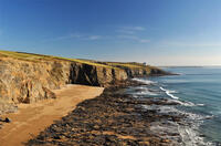
Porthleven to Rinsey Head
6.8 miles/10.9 km - Moderate-strenuous
A circular walk from Porthleven to the cliff-edge engine houses of Rinsey Head and Trewavas where the under-sea mine, set out with tables and food for the annual Tribute dinner, is said to have been breached by the sea just minutes before all the miners were due underground.
-
7.7 miles/12.4 km - Moderate-strenuous
Zennor to St Ives (via bus)
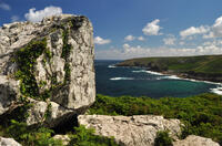
Zennor to St Ives (via bus)
7.7 miles/12.4 km - Moderate-strenuous
A fairly demanding but rewarding one-way coastal walk, made circular via an initial bus journey, along the rugged coast between St Ives and Zennor, passing Seal Island which may have given rise to the legend of the mermaid of Zennor and - thanks to some imaginative naming - ice cream (Moomaid of Zennor). The walk is in the optimal direction to remove time pressure and for panoramic views across St Ives bay.
-
12.1 miles/19.4 km - Moderate-strenuous
St Ives to Zennor
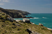
St Ives to Zennor
12.1 miles/19.4 km - Moderate-strenuous
A fairly long and demanding but rewarding circular walk along the coffin path and rugged coast between St Ives and Zennor. The walk is organised so that the coastal section is in the optimal direction for panoramic views across St Ives bay.
Download the iWalk Cornwall app and use the QR scanner within the app to find out more about any of the walks above.
