

Circular walks around Bodmin
Enjoy the walks by being guided by the app


-
5.3 miles/8.5 km - Easy
Dunmere to Grogley Halt

Dunmere to Grogley Halt
5.3 miles/8.5 km - Easy
A circular walk along the Camel valley from Dunmere Halt to Grogley Halt on the Camel Trail, passing the Camel Valley vineyard and the Boscarne platform where the Bodmin-Wenford steam trains depart.
-
2.5 miles/4 km - Easy-moderate
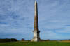
Bodmin town and beacon

Bodmin town and beacon
2.5 miles/4 km - Easy-moderate
A circular walk to the Beacon Local Nature Reserve, Jail and through Bodmin's historic centre.
-
2.7 miles/4.4 km - Easy-moderate
Blisland to Lavethan Wood

Blisland to Lavethan Wood
2.7 miles/4.4 km - Easy-moderate
A short circular walk from the village of Blisland through the churchyard, two stretches of the Woodland Trust reserve of Lavethan Wood and land which was once the estates of Lavethan and Barlandew manors.
-
3.2 miles/5.1 km - Easy-moderate
Lanhydrock Gardens

Lanhydrock Gardens
3.2 miles/5.1 km - Easy-moderate
A fairly short and easy circular walk through Lanhydrock gardens with plenty of picnic spots along the River Fowey that you can combine with a visit to the house.
-
3.8 miles/6.1 km - Easy-moderate
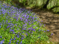
Lanhydrock to Respryn

Lanhydrock to Respryn
3.8 miles/6.1 km - Easy-moderate
A circular walk through the mature broadleaf woodland in the less well-known areas of the Lanhydrock estate, through bluebell woods and along the River Fowey, past the mediaeval bridge at Respryn, built after numerous prayers for safe passage in the ford-side chapel, had not resulted in the desired outcome.
-
3.7 miles/5.9 km - Easy-moderate
St Mabyn to Pencarrow House

St Mabyn to Pencarrow House
3.7 miles/5.9 km - Easy-moderate
A fairly easy circular walk from St Mabyn past the church and through rolling countryside to Pencarrow House and its magnificent gardens.
-
4.5 miles/7.2 km - Easy-moderate
Cardinham Woods and Lady Vale
Cardinham Woods and Lady Vale
4.5 miles/7.2 km - Easy-moderate
A circular walk in the wooded valley surrounding Cardinham Water where the mediaeval chapel of St Mary de Valle once stood but now only the Lady Vale mediaeval bridge remains.
-
3.2 miles/5.2 km - Moderate
Helman Tor and Red Moor

Helman Tor and Red Moor
3.2 miles/5.2 km - Moderate
A circular walk to the neolithic enclosure on the summit of Helman Tor and through the woodland of Cornwall's largest nature reserve.
-
3.6 miles/5.8 km - Moderate
Withiel and Tremore Valley

Withiel and Tremore Valley
3.6 miles/5.8 km - Moderate
A circular walk in the Ruthern and Tremore river valleys following the Saint's Way to Withiel where the award-winning cheese Cornish Yarg was first made from a recipe in a dusty book found in the attic, that is thought to date back to the 13th Century.
-
4.3 miles/6.9 km - Moderate
Treslea Downs and Warleggan

Treslea Downs and Warleggan
4.3 miles/6.9 km - Moderate
A circular walk at one of Cornwall's more remote and eccentric hamlets, displaying a "twinned with Narnia" sign and with a church where the vicar surrounded his rectory with barbed wire and preached to an empty church containing name cards of his parishioners
-
4.7 miles/7.6 km - Moderate
Cardinham and Bury Castle

Cardinham and Bury Castle
4.7 miles/7.6 km - Moderate
A circular walk in the tributary valleys of Cardinham Water to the remains of the Bury Castle hill fort where the ramparts are still over 14ft high even after more than 2000 years.
-
5.2 miles/8.4 km - Moderate
Bodmin and Bodiniel - the two manors

Bodmin and Bodiniel - the two manors
5.2 miles/8.4 km - Moderate
A figure-of-8 walk through Bodmin's historic centre to the beacon nature reserve and through the woods at Dunmere to Scarlett's Well
-
5.3 miles/8.5 km - Moderate
Lanhydrock to Restormel

Lanhydrock to Restormel
5.3 miles/8.5 km - Moderate
A circular walk from the mediaeval bridge at Respryn along the River Fowey through the bluebell woodland of the Lanhydrock Estate to the circular Norman castle at Restormel which had a pressurised piped water system 700 years ahead of its time.
-
5.7 miles/9.2 km - Moderate
Hellandbridge to St Mabyn

Hellandbridge to St Mabyn
5.7 miles/9.2 km - Moderate
A circular walk from Helland's mediaeval bridge through bluebell woodland and the fields overlooked by the Iron Age rounds at Pencarrow to the Norman church at St Mabyn, dedicated to the daughter of a Celtic King, and returning via the stump of the Neolithic Long Stone which stood for millennia until it was broken up for gateposts in 1850.
-
6.1 miles/9.9 km - Moderate
Dunmere, Penhargard and Bodmin Jail

Dunmere, Penhargard and Bodmin Jail
6.1 miles/9.9 km - Moderate
A circular walk along the River Camel from Dunmere through bluebell woods and fields to Penhargard, and along an ancient route lined with wildflowers to Bodmin's historic jail.
-
6.1 miles/9.9 km - Moderate
St Wenn to Withiel

St Wenn to Withiel
6.1 miles/9.9 km - Moderate
A circular walk from St Wenn in the upper reaches of the Ruthern Valley, through Rosenannon woods and along the Saints' Way pilgrimage route to the mediaeval church at Withiel, where the Rector shut down The Pig and Whistle for being an ungodly establishment.


Download the iWalk Cornwall app and use the QR scanner within the app to find out more about any of the walks above.
